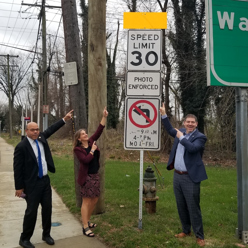
State delegates Al Carr, Lorig Charkoudian, and Jared Solomon point to the new speed limit sign on Georgia Ave. Photo by Michelle Desiderio Foster
The first of the long-awaited Georgia Ave. improvements in Montgomery Hills was implemented recently when the State Highway Administration (SHA) lowered the speed limit to 30 mph (from 35 mph) on Georgia Ave. from Spring St. to Wheaton. This speed limit was recommended in the Planning Department’s Montgomery Hills/Forest Glen Sector Plan adopted a few years ago. The speed reduction was just one of the significant improvements proposed for the corridor, including a green median, removal of the unsafe reversible lanes, wider sidewalks, a cycle track on the west side of the road, pedestrian-safety enhancements, a reconfigured Beltway interchange, and a new traffic light at Flora Lane.
A completed SHA design is expected by the end of 2022. Funding has been allocated for most of the necessary right-of-way acquisitions, and the county and state are cooperating to secure funds for utility relocation and construction. U.S. Senator Chris Van Hollen secured one million dollars in federal funding for the project in the recent infrastructure bill that Congress approved. Utility relocation could start as early as January 2024. State Delegates Jared Solomon and Lorig Charkoudian have worked tirelessly on this project to ensure that it continues to move forward and to secure necessary funding.
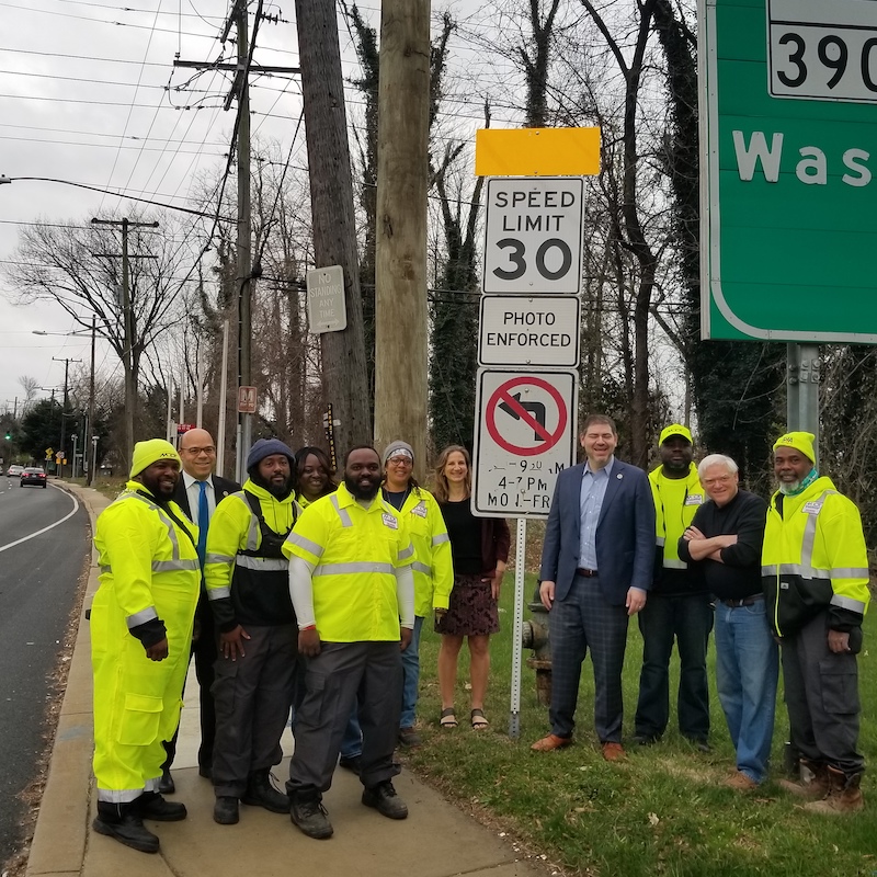
State delegates Al Carr, Lorig Charkoudian, Jared Solomon and State Highway Administration employees pose near the new speed limit sign on Georgia Ave. Photo by Michelle Desiderio Foster
Enter the property address in the box at the top: A map identifying your property within its neighborhood context will appear.
Double-click within the boundary line of the property (zoom in first, if necessary), and a box showing basic property details will appear (owner, land use category, assessment date, year built, etc.).
Click on Data Description at the top of the box for a brief description of each piece of data listed; of most importance are the liber and folio numbers. This set of numbers constitutes the first deed in your chain of title.
Your next stop is the Maryland Land Records Database. You’ll need to submit a request for an account before you can access the database. Once you have your account and the liber and folio number for your property’s current deed, you can begin searching. It’s always best to start with the current deed, even if you’ve identified previous deed information.
Select your county (Montgomery) from the upper-left drop-down menu.
On the search page that opens, search using the top box, titled “Jump to New Volume,” searching via liber and folio numbers.
Skipping the Clerk box, enter your liber number in the Book box and your folio number in the Page box.
The deed document that opens will be the current deed for your property, which should list the current owners as the grantees (buyers), along with the grantors (sellers). It will provide the date of the property transfer and a description of the property, often including the lot number, block number, subdivision name, and the location within Montgomery County Land Records of the document recording the original platting of the subdivision within which it is located. (For example, “…the west 50 feet in width of Lot No. 3, in Block No. 20 by the full depth of 150 feet, in the subdivision of land known as and called B.F. Leighton’s Addition to Woodside, as per plat recorded in Plat Book A, Plat No. 60.”)
With this information, you can visit plats.net. Start by selecting Montgomery County in the drop-down menu, and when the Basic Search box appears, enter the plat book number and plat number in the appropriate boxes. You should see the name of the appropriate subdivision and a hyperlink to an MSA (Maryland State Archives) accession number. Click on this link, and you will be taken to the original platting record of the subdivision (usually a map of the subdivision) within which your property resides.
At this point you know the starting point (current deed) and ending point (subdivision platting) of your chain of title, but you must fill in all the deeds in-between. To do this, return to mdlandrec.net and begin working your way backward from the current deed.
In the current deed, somewhere below the property description, there may be a paragraph that notes the liber and folio number of the previous deed. If so, return to the search page and enter this information, and continue following this process until you reach a deed that does not list the previous deed’s information. Unfortunately, this may happen at almost any point in the chain of title search.
When this happens, return to the main Montgomery County Land Records Indices page.
If the oldest deed you locate is from 1977 or later, click on “Individual Search” or “Corporation Search” in the left-hand column. This is a straightforward search process that involves entering the name in question and the date parameters.
If the oldest deed you locate is from 1976 or earlier, click on “Active Indices” in the column on the left. Since the grantee name is the only name you know at this point (i.e., the grantor on the oldest deed you’ve located), click on “Land Records, Grantee Index, 1777–1976” in the drop-down menu. Then choose which block of dates you want to search within. Begin with the most recent block of possible dates for the deed you’re searching for; for example, if your earliest known deed is dated March 5, 1975, begin with the indices from 1973–1977. Under this block of dates, look for the first letter of the owner’s surname, or corporation name, and then the first letter of their given name. Once this page opens, click on the red hyperlink on the right — “How to Use Montgomery County Land Record Indices” — for an overview of the process used to continue your search from here. Once you find the next-oldest deed, the previous deed’s liber and folio numbers may be listed here, but if not, repeat the process of using the Active Indices search option (or Individual/Corporation search, if it’s still later than 1977) to continue to work backward. You’ll know you’ve reached the end of your chain of title when you locate the deed in which the name of the grantor is the individual or corporation that platted the subdivision in question.
The most user-friendly source of historic newspapers is the Library of Congress website “Chronicling America” (chroniclingamerica.loc.gov), which provides free access to a searchable network of digitized newspapers from across the country. The Advanced Search tab allows you to select a specific state, or the District of Columbia, to search within, and gives you multiple options for key word searches.
For Montgomery County, it is always a good idea to try each search in both Maryland and the District of Columbia. The “Evening Star” (Washington, D.C.) was considered the newspaper of record for many decades, and it is also a wonderful source of social news for the city and the surrounding counties. The “Montgomery County Sentinel” is another important local newspaper in the database.
Editor’s note: If you would like to be part of an organized approach to neighborhood history research — or if you come across any interesting information related to neighborhood history that you’d be willing to share with neighbors — contact the North Woodside History Group.
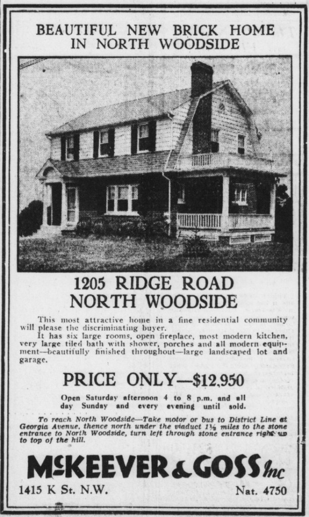
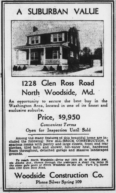
On February 16, 2022, many neighbors tuned into an online training by Kirsten L. Crase, PhD, University of Maryland, on how to research the history of their homes. The training inspired a search of historic newspaper digital archives for articles related to the neighborhood. Among many fascinating finds, neighbors uncovered a plethora of original advertisements for North Woodside homes. Can you find these homes today?
Source: Evening Star (Washington, D.C.), Chronicling America: Historic American Newspapers. Lib. of Congress. Dates/Pages (left to right): September 15, 1928, Page 23; August 21, 1936, Page 16; September 6, 1930, Page B2; April 25, 1931, Page B2.
Many of the old North Woodside advertisements, such as the large one above, tout the “exclusive” nature of the community and “the protection of its sensible restrictions,” not-so-subtle allusions to racially restrictive deed covenants.
For more information on researching the history of your home:
Personally, I’m not a fan of change. Snider’s, under the new ownership, still feels a bit weird to me every time I go in; I miss our neighborhood Staples even though Aldi replaced it some time ago; and I’m still adjusting, almost eight months later, to being an empty nester. Plus I can’t quite believe houses in North Woodside are now selling for a million dollars, some for over a million dollars. Maybe your house is worth that already. Wow. Can I mention that my husband and I bought our house in 2000 for $217,500? I don’t think our modest bungalow is worth $1,000,000 quite yet, but it’s now worth so much more now than I ever imagined it would be.
So change has already come to North Woodside. We are at the center (okay, technically bottom center) of a growing, affluent county bursting with new folks bringing innovation and eagerness to succeed right to our doorstep. But this boon is creating a big problem — lack of housing. It is one of the reasons our houses have increased so rapidly in value. Everyone wants to live in North Woodside. (And why wouldn’t they? It’s lovely, and close to shopping, good schools, and transportation.)
According to a recent Washington Post article, “(t)he supply shortage has grown so severe across the D.C. area that, in 2019, the Metropolitan Washington Council of Governments issued a sweeping call for local leaders to aggressively ramp up housing production. The association advised governments to approve a total of 320,000 homes by 2030, with a focus on affordably priced housing near jobs and transit.”
So Montgomery County has decided to embrace this population growth — it’s already proved to be a boon to our area, economically and culturally — and even plan for it. Because without a plan growth can cause problems, of course. It can strain services, increase commute times, worsen environmental conditions, and exacerbate inequality.
The plan, created by our Montgomery County Planning Board, is called Thrive Montgomery 2050 (Thrive). Maybe you’ve heard of it? It’s a 30-year blueprint for population growth in our county that also addresses environmental and climate concerns, transportation, open-land preservation, quality-of-life issues like walkability and public art, and the pressing need for racial equity and social justice. If you’re not familiar with it, check out the Thrive section on the montgomeryplanning.org website.
I was delighted to be part of the team of NWCA Board members that brought together lots of folks with different perspectives to discuss the housing and zoning aspects of Thrive, and what changes it might bring to our corner of the county, at a neighborhood forum back in March. After planners from the Planning Board presented a quick outline of Thrive, North Woodside residents asked excellent questions of the six panel members representing all sides of the issue.
I was even more delighted that the neighborhood survey on Thrive, sponsored by the NWCA Board, garnered a record-breaking response, with 111 neighbors representing 99 households participating (a nearly 40% increase in individual participation — and at least 25% by household — compared to the last survey we conducted in Fall 2019). The results of the survey, which are available on our website, showed that a majority of the neighbors who took the survey support the way the county proposes to plan for the future.
Thrive Montgomery 2050 is still under review, and won’t be voted on by the County Council for a few more months (so there’s still time to make your voice heard!), but even before a plan is put in place, I’m grateful to live in a county that is committed to creating a green, just, and inclusive way to deal with a future of growth and change. It makes thinking about the coming changes easier for me, including the addition of much-needed housing to our area. I hope it does for you, too.
The above letter ran in the Spring 2022 issue of the Beacon.
Under the inspired leadership of Bertie LoPiccolo, neighbors and friends gathered on an unseasonably beautiful President’s Day to help Julie Savage and Keith Carlson lay a mosaic path leading to their newly built backyard ADU (accessory dwelling unit).
“I dreamed of building a healing, welcoming ADU space for my small therapy practice and imagined a whimsical, joyful path leading up to it — a piece of community artwork that would bring people together. Bertie caught the vision and made it happen, with the added expertise of Suz Podrasky and many first-time mosaic artists.
Close up of a mosaic flower
In the days leading up to pouring the concrete, I gathered small mosaic creations from anyone who had any inclination to contribute. (Thank you to so many in the neighborhood!) The finished path is a magical collection of birds, bugs, trees, words, a cicada, rainbow, sun, moon, small house, and so much more.
Feel free to come to 1914 Grace Church Rd. and check it out anytime. In challenging times, I hope it will be a reminder of all the good that is possible when we come together in new and beautiful ways.”